
Follow a West Haven Street from Address to Evidence
The best street directory workflow begins with the place, not a guessed name. West Haven's assessor and MapXpress systems identify the parcel and recorded owner, but ownership alone does not prove residence. Deeds show transactions and legal interests. Voter material is governed by its own access and use rules, while annual directories can preserve an older household snapshot. Keep a source log with the query, date, address spelling, parcel ID, record role, and result.
- Enter the house number and street in MapXpress, then record the situs, owner or co-owner, and parcel ID.
- Open the GIS viewer, select that parcel and nearby parcels, and note layer names and dates before drawing conclusions.
- Use the Registrar of Voters or state voter route only within its stated public-access and purpose limits.
- Search the owner as a grantor or grantee in the West Haven SearchIQS land index, then follow book, page, instrument, and dates.
- For earlier occupants, compare the street in regional annual and reverse-address directories held by area libraries.
Search the West Haven MapXpress Fields in Order
MapXpress provides the cleanest current bridge from an ordinary street address to a stable parcel identifier. Its property data update nightly, parcel maps update annually, and the portal reports roughly 16,945 parcels. Those schedules matter: an ownership change may reach the property record before a map layer changes.
| Portal field | Best use | What to preserve |
|---|---|---|
| Owner / Co-Owner | Confirm a known recorded owner | Spelling and ownership role |
| House No | Narrow one site on a named road | Number exactly as returned |
| Street | Browse matching situs records by street | Official portal spelling |
| Parcel ID | Return to the same legal tax parcel | Full identifier, including zeros |
- Parcel
- A mapped unit used for assessment and land-record reference. It is not a household.
- Situs address
- The location assigned to the property, distinct from the owner's mailing address.
- Plat
- A recorded map that depicts lots, boundaries, roads, or subdivisions.
- Criss-cross directory
- A directory arranged by street and number so an address can be searched before a surname.
Map a West Haven Street Without Treating Layers as People
The MapXpress GIS viewer turns a street directory search into a spatial check. Select a target parcel, use Parcel Information, and pan to adjacent lots. The viewer offers zoning, wetlands, FEMA mapping, coastal management, fire-tax and voting districts, utilities, road signs, hydrants, sales-year layers, and aerial images ranging from older views through 2023. Each layer describes land or civic geography, not who occupies a home.
The official GIS viewer shows this layer-rich setting in context. See the West Haven MapXpress map before reviewing the captured interface.
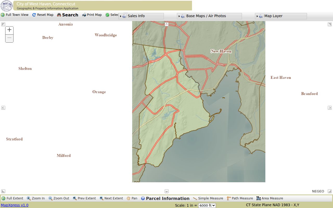
The capture helps identify the selection and navigation controls; always record the layer year and recheck the live map for current conditions.
West Haven Street Directory Record Coverage
No single source lists all people at an address. This coverage table keeps each West Haven record set tied to what it can actually establish and shows the fallback when a public web search is absent.
| Address-keyed source | Custodian | Evidence available | Access route |
|---|---|---|---|
| Parcel and grand list | West Haven Assessor / MapXpress | Owner, co-owner, situs, assessment, sales and parcel geography | Public search; assessor office fallback |
| GIS layers | City GIS / MapXpress | Boundaries, adjacent parcels, zoning, districts, aerials and infrastructure | Public viewer and Parcel Information |
| Deeds, liens and maps | West Haven City Clerk / SearchIQS | Recorded parties, document type, date, book/page, instrument and some images | Guest search; clerk for omitted material |
| Permits and code files | Building, Planning, Property Maintenance | Applications, inspections and construction or code history if retained | Department request or Connecticut FOIA |
| Voter and district records | West Haven Registrars / Secretary of the State | Registration and polling context subject to current law | Official lookup or controlled request route |
| Historical address directories | WHPL, NHFPL and archives | Annual household, business and address-section snapshots | Reference desk, microform, books or verified scans |
The parcel ID connects assessment and map work. A recorded owner name then opens the deed index. Directory evidence or a lawfully obtained civic record may address occupancy, but every name must retain its source role.
Move from a West Haven Parcel to SearchIQS
SearchIQS is a land-record index, not a guaranteed by-address resident search. Generic address-search guidance warns that municipalities do not all index addresses consistently. Begin with the MapXpress situs and owner, then query the surname-first Party fields. Use partial spelling or an asterisk when appropriate, adjust From and Thru dates, and test document group or description. Book/page, instrument number, and case number offer more exact returns.
The official SearchIQS search-screen guide explains the party and document controls illustrated below.
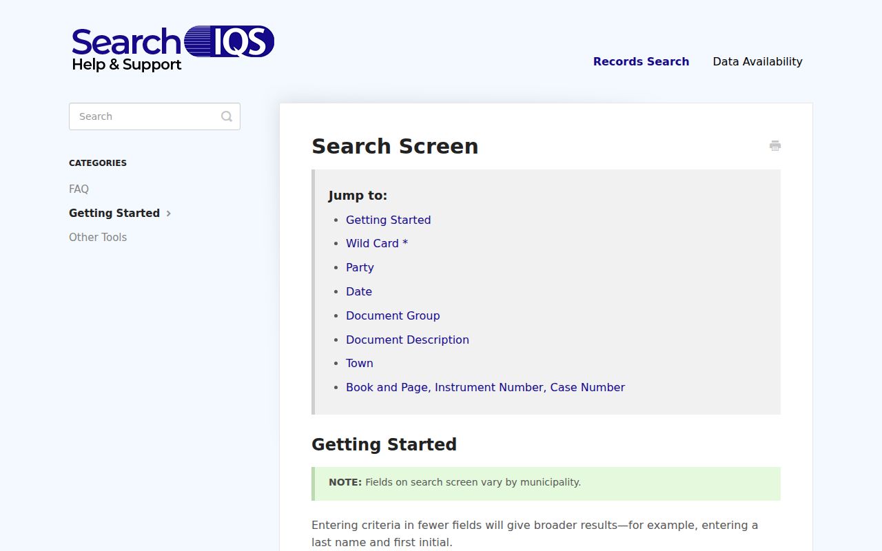
The captured fields show why a street address should be converted to an owner name and parcel clue before deed searching.
If an older document does not appear, remove the town restriction because not every instrument is indexed to a town. Search both party roles unless the chain requires one. Results can be sorted by columns, and View opens an image when available. An index entry is still a locator, so retain the instrument citation and verify the record image or clerk copy.
The official SearchIQS address-search guidance documents the limitation shown in this separate capture.
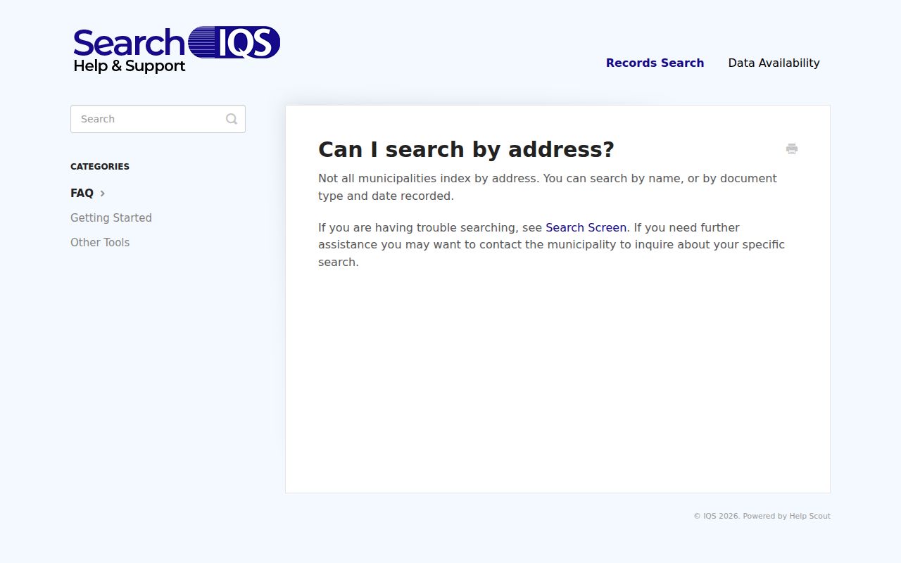
The guidance confirms why the West Haven workflow begins with MapXpress and changes the address into owner and deed-index clues.
The SearchIQS Map-Date Quirk in West Haven
The West Haven help table and the linked PDF coverage sheet do not give the same map dates. The help page says maps reach from January 28, 1939 to the present. The PDF instead describes a January 11, 2005 to October 21, 2013 index period and index-plus-image coverage beginning October 22, 2013. That conflict should stay visible rather than being smoothed into one false range.
For land records, the firmer bridge is grantor/grantee index books from 1956 through 1968, an online land index beginning July 1, 1968, and image coverage mainly from August 16, 1999 onward. Property and sewer liens begin May 8, 2012 in the published table. Ask the City Clerk which map range and image set are currently searchable.
The published West Haven availability table is preserved in the capture below.
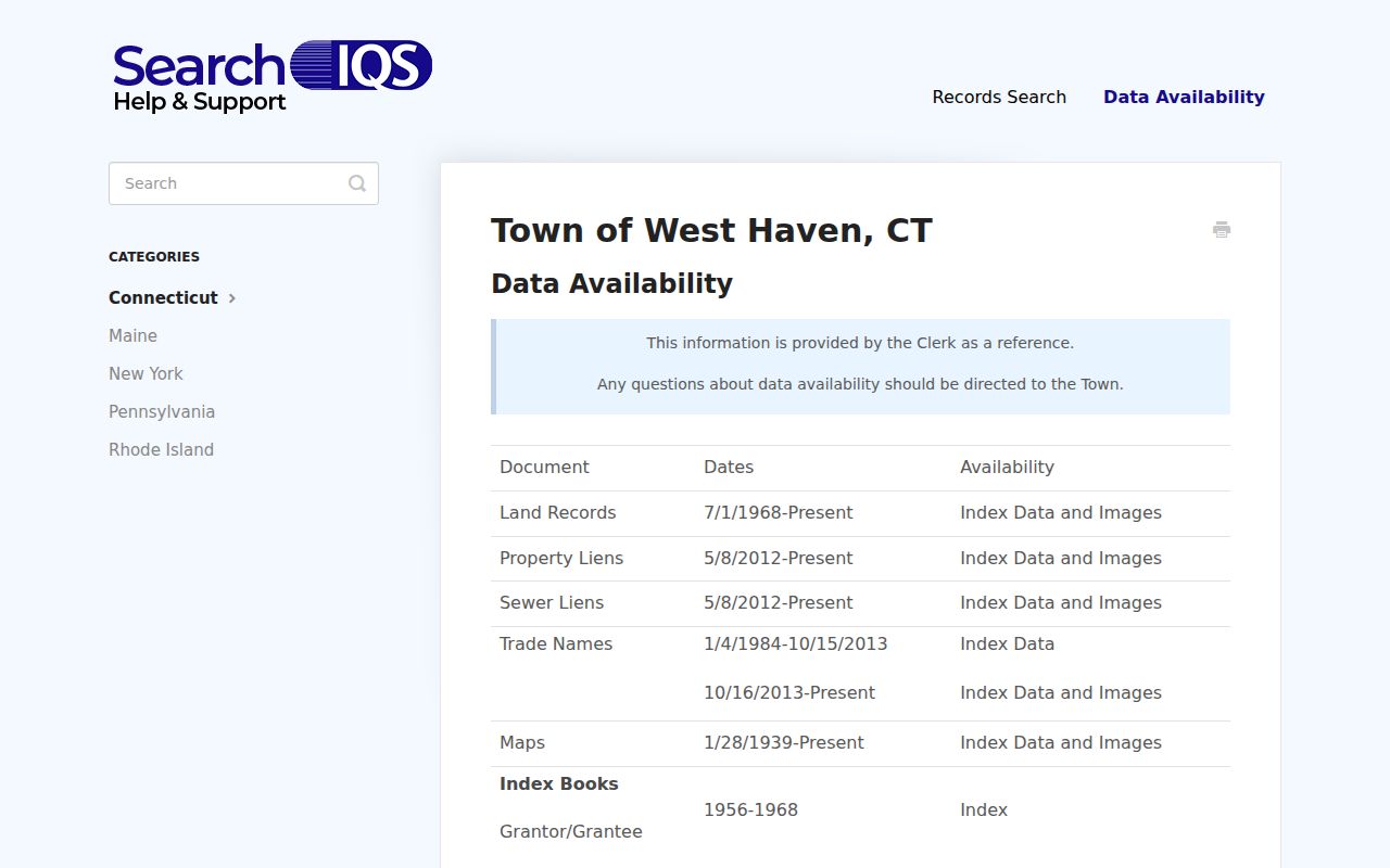
Use the live table as a current portal guide, then ask the clerk about the conflicting map dates and any material outside its listed ranges.
Request West Haven Permit and Planning Files by Address
No public address-keyed permit or code-case search was located in the research. The proper street directory fallback is direct: identify the responsible Building, Planning, or Property Maintenance unit, describe the address and date span, and request the existing record. Connecticut FOIA routes the request to the agency that keeps it; it does not require an agency to create a new household list or answer a research question.
The city's Planning and Development page supplies the official route pictured here.
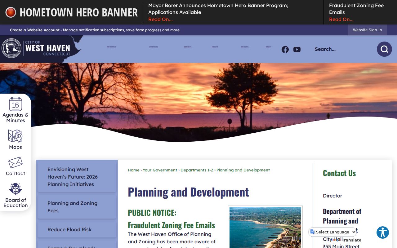
Use that office route to ask for defined permit, zoning, inspection, or application records, and beware of the city's warning about fraudulent zoning-fee emails.
West Haven Owner, Occupant, Mailing and Situs Clues
A parcel result can list an owner or co-owner while the mailing address points elsewhere. That does not prove the owner moved away or that another named person occupies the site. Regional GIS schema separates Owner, Co_Owner, Owner_Occupied, Mailing_Address fields, situsaddress, situszipcode, and parcel ID. Preserve those distinctions whenever the local card exposes them.
The same caution applies to voters and businesses. A voter source serves election administration under statutory limits. A business filing may identify an agent or principal. Neither becomes a complete street directory simply because it contains an address. Require two independent details, such as the same address and date, before treating records as clues about one person.
A West Haven Street Can Outlive Its Municipal Label
Older address work must account for West Haven's civic sequence. The area can appear as West Farms within New Haven, later under Orange, then as the independent town of West Haven after 1921 and the city after 1959. Allingtown and New Haven can also be useful regional directory terms. A failed modern-name search is therefore not proof that the street or household vanished.
Test period spellings, abbreviations, nearby numbers, and editions on either side of the target year. The research found no complete official street-renumbering history, so do not claim a specific renumbering. If numbers shift, compare parcel legal descriptions, map references, neighbors, and annual directory entries, then ask the City Clerk, Assessor, library, or Historical Society for documentation.
Turn a West Haven Street Directory Backward in Time
New Haven Free Public Library reports regional city-directory holdings from 1840 to about 1990, with complete microform coverage from 1840 through 1960 and good book coverage into about 1990. West Haven and Allingtown can appear within regional Price & Lee volumes. Address sections, available from about the 1920s, let a researcher invert the alphabetical directory and examine a street number first.
Log the edition, page, printed street form, household names, business entry, and any “h” home notation. Compare adjacent annual editions because a missing entry may reflect a skipped volume, abbreviation, household-head change, or address change. For a deeper backward trail, the West Haven city directory collections page explains the shelf and entry conventions.
Why ZIP Does Not Complete a West Haven Street Search
West Haven's confirmed city ZIP is 06516, but a USPS delivery ZIP, Census ZCTA, parcel situs ZIP, and an owner's mailing ZIP are not interchangeable. MapXpress exposes house number, street, owner, and parcel ID rather than a proven ZIP-wide public search. ZIP is therefore a sorting clue, not evidence of city limits, parcel identity, or residence.
This distinction prevents a common street-by-street error: grouping records because the same five digits appear while ignoring their different purposes. Use the legal parcel and situs for land work, the official delivery lookup for mail, and ZCTA data only for generalized statistics.
Limits of a West Haven Street Directory
A street directory cannot identify every person who lives at a property. Parcel records focus on ownership and assessment. Deeds focus on recorded legal acts. A directory may list only the head of a household, miss an apartment occupant, or lag a move. DMV addresses are protected by federal and Connecticut privacy rules, while Safe at Home and the voter privacy program can suppress qualifying addresses.
Absence is not a negative finding. The portal may lack the year, an image may be restricted, a record may use an old municipality label, or the person may never have appeared in that record type. State the exact source and date checked, then use the custodian fallback rather than filling a gap with inference.
Lawful use. Use West Haven address records for lawful personal research, and never use them to stalk, harass, intimidate, or harm anyone.